The coast of the Kimberley is a long, convoluted boundary between the desert and the sea, stretching into many long peninsulas and indented by bays and inlets, many of them guarded by archipelagos of low rocky islands. Measuring this coastline on a small-scale map gives a figure of about 250 miles, but if you zoom in and measure each cove and headland carefully the distance turns out to be over 800 miles! This is a flooded shore – the deep harbors leading to today’s rivers were formed as river valleys themselves and then inundated by the rising sea following the retreat of the great glaciers of the ice age.
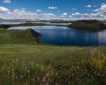
Coasting along this meandering border between red rock and blue ocean, it is difficult to get a feeling for the scale of the place – we seem to encounter it in discreet patches, a river here, a gallery of ancient art there. But today, anchored in the huge bay of Prince Frederick Harbor, we had a chance to see a broader perspective and gain an appreciation of the real dimensions of the Kimberley.
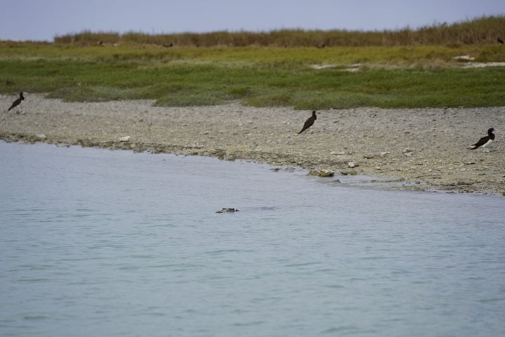
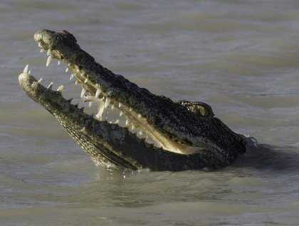
Rising early, we set out in the Zodiacs, up the Hunter River and into Porosus Creek, an inlet named for the many salt-water crocodiles, Crocodylus porosus, that live there. We had an excellent low tide for our explorations: extensive mud banks were exposed below the mangroves. Crocodiles were not hard to find! Some were out on the banks, warming up in the bright sunshine, while others were busy fishing in the small streams that fed the larger inlet. Between croc sightings we kept busy with watching the egrets, sea eagles, and kites that were also busy feeding while fish were concentrated by the low water.
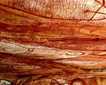
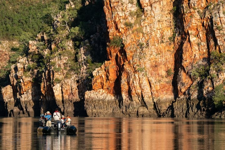
After a quick break for lunch some of us set out again, this time into the wide expanse of Prince Frederick Harbor beyond our anchorage. In the hazy distance a string of low islands nearly enclosed the bay and although we only cruised out to the nearest point of the inside coastline it was an impressively long transit. With Porosus Creek behind us and a good feeling for the breadth of the big bay ahead, we finally had a clear sense of the true dimensions of the Kimberley coast, stretching far to the east and west, dividing the desert from the sea. And, as has been the case throughout our voyage, we encountered small gems of detail that brought each mile of the shore to life. Osprey soared over their nests, a small sea cave invited a look into the shadows and a tall pillar of sandstone striped with bands of calcite crystals held a huge cap that earned it the name “Thor’s Hammer.”
So now we are slowly coming to know the Kimberley – it’s a big place, many miles of red sandstone headlands lead to one huge bay after another, each one a unique and beautiful sight, constantly inviting us to look more closely and see even more.