
After spending the night with the ship parked in the ice, we reversed out and continued making our way north. The plan was to hike, and after a short search for a landing site, we found a great spot for hiking in Augustbukta.
There is an old trappers hut here, with a sad story. The hut was used for only one season in the winter of 1933, when an accident killed the two trappers. No one has ever found the truth about this event, but when the ship came to pick up the trappers in the summer, the hut was destroyed by an explosion, and the diaries showed that the writings ended in January. There have been a few more of these sad stories of accidents during trapping, testament to the hard living these trappers endured.
The landscape is really different here on the east side of Svalbard compared to the west side, where we just came from. There are no sharp and pointy mountains, but only plateaus and snow-capped mountains that have been carved by glaciers. Since there is no impact from the Gulf current here on the east side the climate is a lot colder, which leads to less vegetation.
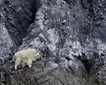
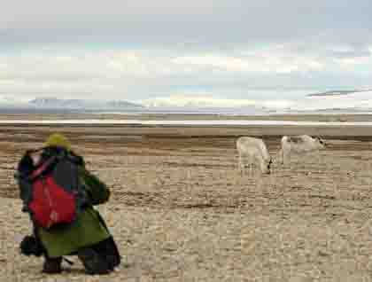
Despite the lack of vegetation, we found a number of reindeer on our hike. It is impressive to see that reindeer are able to survive here under such harsh conditions. The reindeer need to build up a fat storage during the short and hectic summer that will keep them alive during the cold and long winter. When we see how little vegetation there is here on the east side, it makes one wonder how they are able to build up a sufficient fat layer.
The reindeer have developed strategies like picking out the most nutrient-rich plants. Even more important, as the spring and flower blooming continues from sea level to the higher elevations, the reindeer will follow the cycle of blooming, feeding on the plants as they start to grow/bloom as the season progresses.
Some of us were able to take a long hike to get on top of a mountain, giving us a panoramic view of the ship at anchor in Augustabukta here on Nord Austlandet.
In the afternoon we had a nice cruise along the world’s third-largest icecap – Austfonna. This glacial face is over 100 miles long, and the icecap covers almost 50% of the island Nordaustlandet. This glacier had a surge – an outflow of glacier ice around 1930 that resulted in the glacier name Braasvellbreen (meaning “sudden swell glacier”) – and this part of the icecap still carries this name. Surveys show that the glacier is building up in the middle and diminishing on the sides, so there are signs that it might be surging again.
This was a perfect ending to a really good day here on Svalbard, as we continue to explore this beautiful landscape.