During the night we sailed between Edgeøya and Barentsøya, and through Freemansundet. Both islands are named after the early explorers which ventured into the area. Wilhelm Barentz was the pilot on the Dutch mission in 1596 to find a short cut to Cathay (Chine), going north. Spitzbergen (pointed mountains) became the name of the land he found as he was forced to turn south because of a compact ice wall, the Arctic pack-ice.
Edgeøya is named after the supercargo, Thomas Edge, on board an English ship which came up early 17th century searching for opportunities to harvest the ‘beasts,’ the walrus.
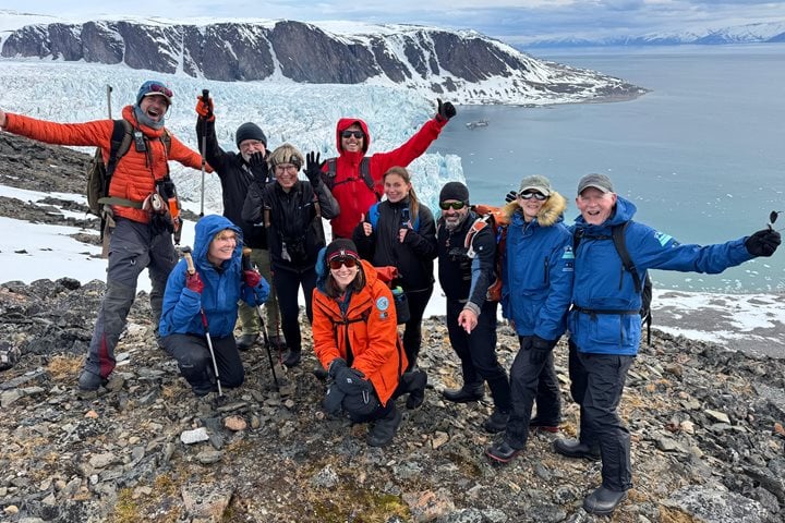
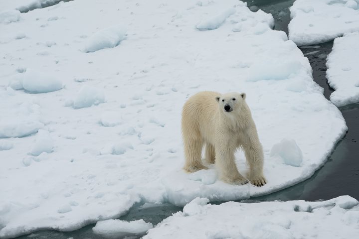
As the morning wakeup call came through, our expedition leader Bud Lehnhausen announced, “Polar bears!” out on the ice. We started this expedition many days ago in Bergen, where mainland Norway was in full spring, and now we had reached the far north. We left trees behind, and now a snow-covered landscape was before us, and we were surrounded by an icescape. It was finally time to use all the gear we had dragged along for the voyage.
Rapidly we learned the difference between shore ice and pack ice. The shore ice is a very important ecosystem for the most common seal in the Arctic, the ringed seal, which is the staple food for the polar bear.
Here the ringed seal breeds in April through early May and it is here the polar bears have the heydays to gain weight after a long dark winter. In the polar region it is all about blubber!
Now we are in the High Arctic, the “land” of white ice bears and walrus, both icons of the north and deeply connected with the sea ice. The Arctic and Antarctic are both Polar Regions but very different. In the north we have a frozen sea surrounded by continents and in the south a frozen continent surrounded by ocean. Here in the north mammals like polar bears and walrus have evolved to survive and are closely associated with the sea ice conditions.
As our day went along we allocated time to search for these Arctic icons and were greatly rewarded. We spotted walrus on ice floes and as we finished the day we had been able to sight at least 11 ice bears. Just as dinner was about to finish up, the captain’s order came through, “Polar bear close, time to finish up!”
The dining room was rapidly cleared and soon everybody was bundled up on the bow, in front of the chart room or above the bridge. This very last polar bear of the day was very cooperative and with some clever navigation we all had great views. How many pictures were taken? Hard to say but we know it will be a busy night editing all photos!
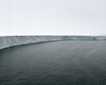
We also tried in the later part of the day to navigate to the north of Hinlopen Strait, the body of water which separates Spitsbergen and Nordaustlandet, but before we reached our aim, a large sea bird colony and a compact wall of ice forced us to turn south.
Our furthest north on this voyage became N79o40’, maybe not as impressive as later expeditions in the year, but considering we made it on the eastern side of Svalbard and today is June 4th, it is something remarkable.
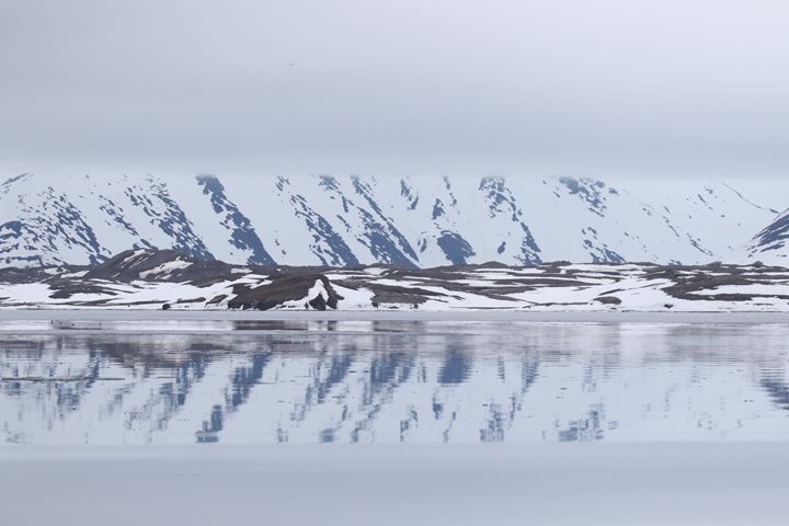
Only 10 years back it was usually hard to find open water in this area before late June or even late into July. The climate change here in Svalbard has made a huge impact and ice conditions are rapidly changing.
To summarize this remarkable day, the words of an early navigator who sailed here in these ice-bounded waters around the early 1900’s, stated every year he came up north: “It is nice to be back in the ice again!” Of course the wildlife is great but still it is the icescape which makes the Polar Regions so special.