Before breakfast our captain slowly brought the ship towards Alkefjellet, located on the Spitsbergen side of Hinlopen, the body of water that separates Spitsbergen and the second largest island, Nordaustlandet. Hinlopen and its strong currents creates unique feeding opportunities for seabirds, and the cliff faces, columnar basalt, establish perfect ledges for maybe 100,000 pairs of thick-billed murres to breed. As we slowly got closer we saw a steady stream of birds flying into the cliffs or out to sea. The prime food target for all these murres is the polar cod that is found under the sea ice. It is almost magical to see birds in these numbers, and looking up the sky is swarmed with them, almost like a mosquito swarm.
The day was of course filled with plans for different landings, but as the day progressed, and being on an expedition, it really became an ice day, first with sea ice and later glacier ice. After our breathtaking morning with all the birds we moved to Plan B, ice bears! The ice charts showed fast ice still lasting in Bjørnsundet (Bear Sound), named so because it usually holds fast ice far into to the summer and of course this was well known by the trappers who came here to hunt polar bears.
Since the polar bear treaty was signed by the five Arctic nations in 1973, here in the Barents Sea the only way to ‘shoot’ a polar bear is through your camera lens as none of the three main islands in the area (Svalbard, Franz Josef Land & Novaya Zemlja) ever housed indigenous people. In other parts of the Arctic they still have the right to hunt and kill polar bears and the last area to implement quota on numbers to be killed was Greenland.
The Barents Sea’s polar bear population has grown since 1973 and is today a very healthy subpopulation, estimated to maybe up to 3,000 animals. Soon we sighted three polar bears on the sea ice, one very large laying on the ice in a typical position, patiently waiting for a seal to show up at its breathing hole. Two more bears were wandering out on the icepack. Additionally, we were surrounded by a magnificent ice and snowscape with ivory gulls overhead calling out their distinct ‘’purrrr.’ Usually the best way to spot this iconic High Arctic bird is to listen for them.
Also during the morning our National Geographic representative, Rich Reid, gave a presentation ‘On assignment with National Geographic,’ while most of the rest of the staff and bridge team were searching for more polar bears. Soon the announcement goes over the PA-system, sorry Rich, and it was time to bundle up again. Several polar bears were seen out on the last remains of the fast ice, including a mother with her single cub.
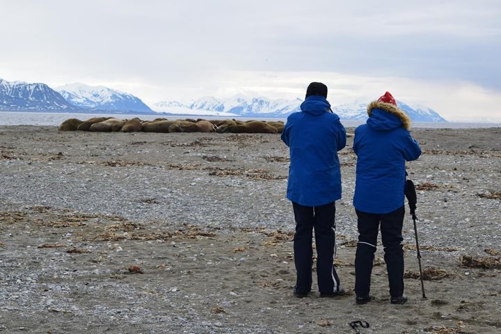
During lunch the ship repositioned crossing over the Hinlopen to the east. The aim was Torellneset, the very southwestern point to Nordaustlandet, to search for brown blubbery creatures with tusks. This beach is a well-known haulout site for walrus, but today the beach was more or less covered by ice and ‘nobody was home.’
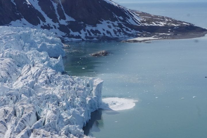
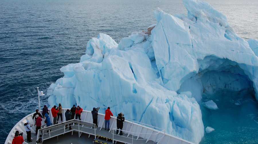
Instead we switched to Plan C and headed for the southwest corner of Wallenbergøya, but again we got forced to change to Plan D and sailed for the glacier wall created by one of the world’s larger ice caps, Austfonna on Nordaustlandet. Well, nothing in con compare to the Antarctic icecap or Greenland, but this wall continues for almost 100 nautical miles and is still impressive to sail along. In the water we spotted a few harp seals making splashes.
Yesterday we made it our furthest north and were only 544 nautical miles away from the Pole (N 80o56’). During the afternoon a presentation was also given on the theme; ‘Who was first to the North Pole?’ Not an easy task to answer and oddly enough the first to ski over the ice to reach this elusive point, without any doubt, was in fact Sir Wally Herbert with his team in 1969 April 6, exactly 60 years on the day after Peary claimed he reached it. Sir Wally Herbert later requested to scrutinize Peary’s logbook and came to the conclusion, Peary never made it closer than 60 nautical miles.
Our last plan was to sail through one of the passages from Olgastretet to Storfjord, either Freemansundet or Heleysundet, but as the prevailing wind during the day had packed both with drift-ice we now went for Plan E, to sail around the southern tip at Edgeøya to reach the island’s western side for tomorrows planned outings. Well, a true expedition day with constantly adapting to the environment and flexibility is a key to success. We started with birds and went onto ice in two forms, sea and glacier. For sure ice is nice.